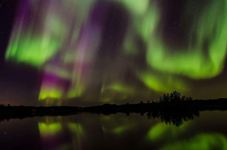
Chasers Mike Rurak and Ryan Keller were out and about last Sunday and mamaged to capture one of the best aurora shows they have ever witnessed.
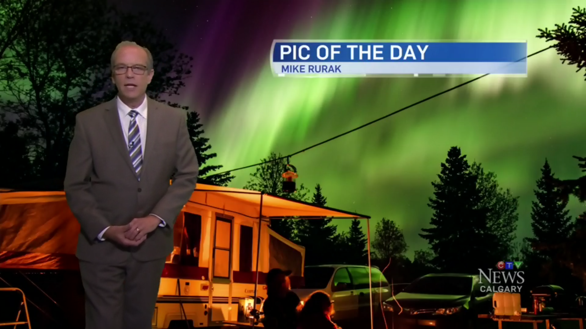
CTV Calgarys David Spence featured them on Tuesdays evening broadcast.
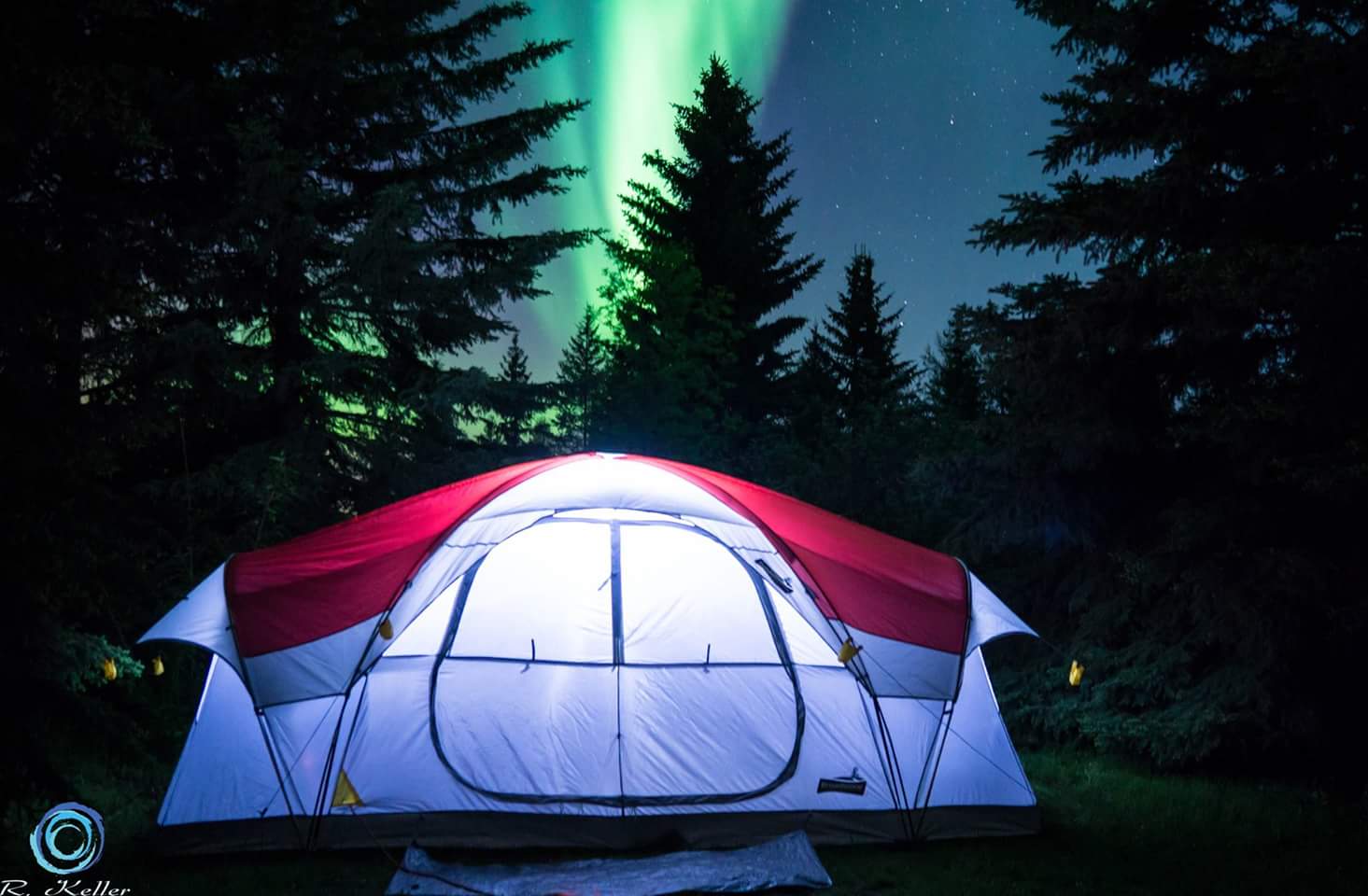
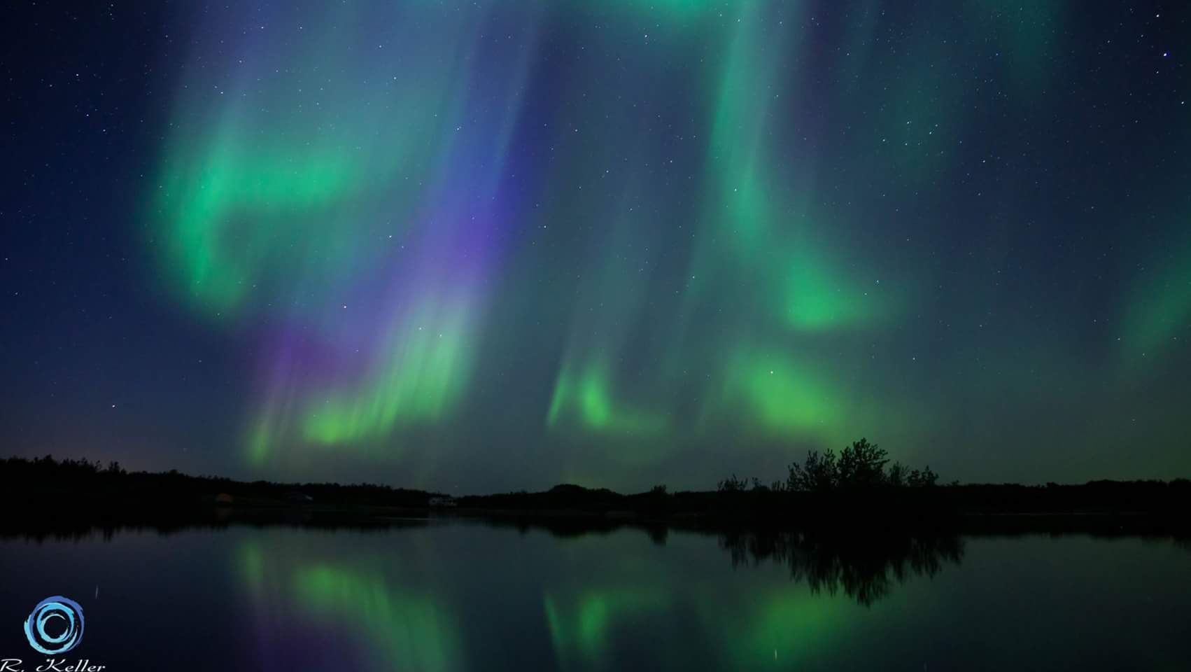

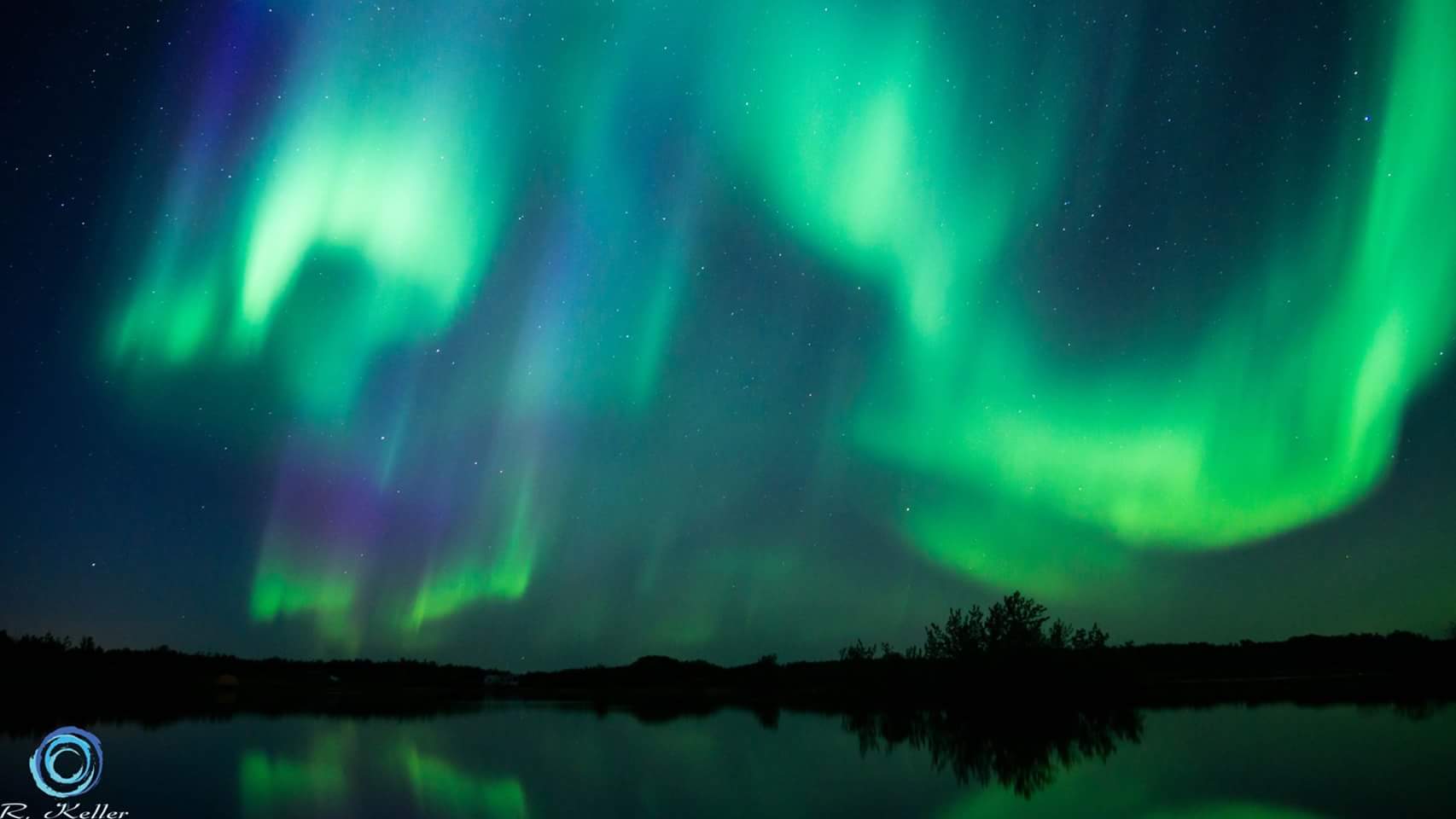

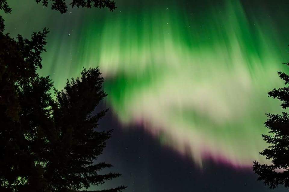

Chasers Mike Rurak and Ryan Keller were out and about last Sunday and mamaged to capture one of the best aurora shows they have ever witnessed.
CTV Calgarys David Spence featured them on Tuesdays evening broadcast.
Posted in Uncategorized
Notice: Forecast models are still in a disagreement over the track, Snow line, and intensity of this Low pressure system. If you live near the expected snow-rain line(Saskatoon, Edmonton, Red Deer, And Calgary) be prepared for no snow at all or 30+cm of snow. It all depends on the track and timing. Thundersnow/thunderstorms may cause higher localized accumulations.
A major spring storm in expected to begin tonight and track through Alberta, Saskatchewan, and Manitoba. There is still some disagreement in the models as for the exact track, and temperatures however it appears the snow-rain line should be the Yellowhead highway, and along the QE2 highway. To the south and east we can expect rain or a mix of rain and snow with little accumulation of snow.
Upwards of 25mm of rain can be expected near the snow line and to the southeast, as well as showers and even thunderstorms.
To the north snowfall amounts well over 30cm can be expected and thundersnow is a widespread general risk.
The maps below are my interpretation of the forecast models. NAM, GFS, GEM global, and GEM Regional over multiple runs.


Details.
Starting off mostly as snow Thursday morning over most areas, switching to rain or mix near and southeast of the snow/rain line around 9am to noon. The snow line will move south overnight Friday, bringing accumulating snow in cities such as Edmonton, Red Deer, Calgary, and Saskatoon. During the day Friday the snow line may not move north again and snow slowly tapers off in Alberta into early Saturday.
Aftermath: Most areas that get heavy snow likely retain that snowpack well into the work week or the following weekend. Record breaking cold is possible Sunday morning as temperatures could dip as low as -15C in Central and Northern Alberta behind the low. Well below normal temperatures could last the rest of next week as well.
Risks:
The risk of flooding is high, especially on the SK side of the storm as the 40-50cm of snow melts into already swollen creeks and rivers.
Wind gusts of 50-80km/h will cause blowing snow and reduced visibility in areas that receive heavy snowfall.
Posted in Uncategorized
Coming into meteorological spring we had a cold and snowy winter in the southwest of the province and a warm and dry winter up north, conditions were near normal over the central portions of the province. The warmth was in part due to a milder January and a very strong February that, many areas saw temperatures soar well over 15C, even in the Capital region. Such heat might not be seen again until well into April.
Spring 2017:
Overall Spring will be colder than normal over much of the southern and northern part of the province, near normal to warmer than normal in eastern Alberta.
An area of warmer and drier compared to normal should extend east from the Capital region due to a lack of any snowpack in addition to seasonal models not showing significantly wet over that area. Precipitation will be above normal over the foothills contributing to a higher flood risk than last year. The rest of the province will have closer to normal rain and snow.


March: Much colder than normal, wetter in the southern part of the province. Dry over East central Alberta.
April: Beginning of cold and very wet, The pattern will transition at some point to a much warmer and drier pattern as a warm pattern builds in the northern part of the province. The area near and east of the capital region possibly reaching the 20s first in the province for the year. Cool and snowy weather lingers along the foothills and southern Alberta. Significant snowstorms are a high risk through much of the province.
May: As northern Alberta warms up colder conditions might linger in the southern part. Heavy snowfall is a risk well beyond the May long weekend. Above normal temperatures may not take hold south until late May or into June.
Some risk notes for spring 2017:
Posted in Uncategorized
