
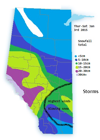
Custom drawn map of expected 3 day snowfall amounts
With about 12 hours now of lead time the models are more in alignment for the incoming snowstorm.
Highest snowfall total are expected in the northern foothills eastward in to the capital region and south. I would expect warnings to be expanded a bit more south and east as some models show the heaviest bands between Edmonton and Red deer.
Models hint at the highest winds being in east central Alberta, around 30-50km/h in spots giving the risk of blowing snow and white-out conditions in those areas. Winds in most other areas in the 20-40km/h range or less will still give poor conditions along the QE2, Yellowhead and other roadways farther west
