Author Archives: Mike R

Hot and humid, all we need now is good shear and a trigger and were set of an epic chase

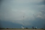
Alberta in now int he grips of a heat wave with temperatures in the 30s and dewpoints up to 20C or more. Some model runs show dewpoints as high as 25C, incredible for Alberta. Currently the shear is in the right direction but is weak. Poor flow aloft is also a problem for the next week. We are expecting 3000j/kg of CAPE or more for a half dozen days. aside from isolated pockets of shear here and there there is no real shear for the next week. just a stagnant “topical island” weather pattern, and most thunderstorms int he next week will probably resemble those encountered in Cuba

Today’s 12Z GFS run shows the heat and humidity lasting now until Tuesday the 17th. that 9 days of constant heat and humidity. And the consensus is that the heat rebuilds after a day or two which means we may be looking at the hottest July on record for Alberta, though it is only a 5 year old record but now the top 3 hottest July’s on record will be in a 6 year period. If we pass the 2007 record the top 3 would be… 2012,2007, and 2006. Either way July 2012 could easily land in the top 3.

AlbertaWX Saskatchewan Chase, So close but no Sky Cigar

A long and somewhat worthwhile chase in Sask on Sunday and Monday. Sunday was short only getting some squall lines in the Loydminster area and went to Watson,SK to spend the night. Monday I left toward the direction of Moose Jaw. First rather appealing HP storm moved through earlier in the day and I checked it out near Linagan. Some of the most incredible thunder I’ve heard in a long time. By now a squall line had formed in SE Alberta So I made my way toward Moose Jaw.

Not knowing the roads in Sask very well(and warnings of still flood damaged highways) I ended up going up to Saskatoon and then back south towards Moose Jaw, barely passing though Saskatoon before a line of hailstorms moved in, by now the moose Jaw area already had tornadoes on the ground and I was going 130km/h to make time. I finally got to it when it was then northwest of Moose Jaw. I stopped in Chamberlain to take some photos of the shrinking meso and got an apparent funnel cloud that at the same time seen on TVNweather
streams. I followed the storm and squall line to Regina and after taking some shots of the mammatus filled sky I headed back on a very long drive, stopping in Medicine hat for the night and then back home.

By far the longest chase I’ve done so far, Sure will make less mistakes next time I chase in Sask, and bring a decent road map as well.

Weather models currently show a flurry of possible severeWX setups in the coming weeks, it looks like a good summer indeed.


Tuesday Update

AlbertaWX is currently now In Watson, SK for the night and will likely head south towards Regina and moose jaw depending on the Models come morning.